Runs Brooklyn, Phase Two
 Although the title of today's post sounds a little like it might be referring to a condo development down in Bergen Beach or something, the real topic is my strategy for running the next major part of Brooklyn. If, of course, you can call what I've come up with a strategy at all, since admittedly it consists of little more than drawing an arbitary line on a map. As I've mentioned on here any number of times, my basic goal for what turned out being the first 35% or so of Brooklyn streets was to start at the southernmost neighborhoods and just fill in all the streets below a line that followed 65th Street (on the Bay Ridge/Sunset Park border) to Avenue P (which separates Midwood from Gravesend and Sheepshead Bay) and onto Flatlands Avenue, which runs through Flatlands and Canarsie and East New York almost to the border with Queens.
A couple of weeks ago (with the run around Floyd Bennett Field), I finally finished this part up, and now, at long last, it's time to announce my strategy for the next few months (I know, the suspense is probably unbearable). So without further ado, here it is: I'll continue working my way north through neighborhoods like Midwood and East Flatbush and Borough Park, while simultaneously working west through East New York and Brownsville. Yeah, I know. Pretty anticlimactic.
Anyway, I've drawn another imaginary line across the borough, this time starting around 15th Street in Gowanus and stretching east to Prospect Park, continuing around the southern boundary of the park itself (Prospect Park South and Parkside Avenue, specifically), on to the few blocks of Flatbush Avenue betweem Parkside Avenue and Linden Boulevard, east on Linden Boulevard out to Rockaway Avenue in Brownsville, up to Cooper Street in Bushwick, and then up to the Queens border. For those who are more geographically or visually oriented, here's a simple map. The blue line shows the northern edge of "phase one" (I know, but I can't think of anything else to call it), while the red line shows the limit of "phase two" (and the black line is the border with Queens):
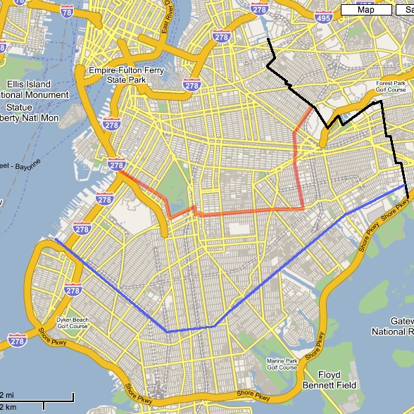
The plan now is simply to run everything between the blue and red lines (and west of the black one, naturally). At this point I'm not really sure when I'll complete all this, but sometime in April seems as good a guess as any. And once I've finished up, as you can see, I'll be left with a nice, compact area centered more or less around Clinton Hill (and none of which should be more than about a 20- or 25-minute subway ride from home, thankfully) for the third and final phase, which will take me into the summer. (For those unfamiliar with Brooklyn's geography, I live in Greenpoint, which is the neighborhood at the very top of the map.) As of now I'm looking to finish running the whole borough by August 1st, provided I can keep up roughly the same pace, don't get run over by an SUV doing 60 down a residential side street, and, of course, I am able to maintain the full use of my legs and feet.
Speaking of, I once again find myself kind of sore (I guess the naproxen's not the miracle drug I initially thought), and I may take tomorrow off, too. But whether I run tomorrow or not, I feel a whole lot better knowing there's some organizing principle behind this next stage of my project, however tenuous it may be.
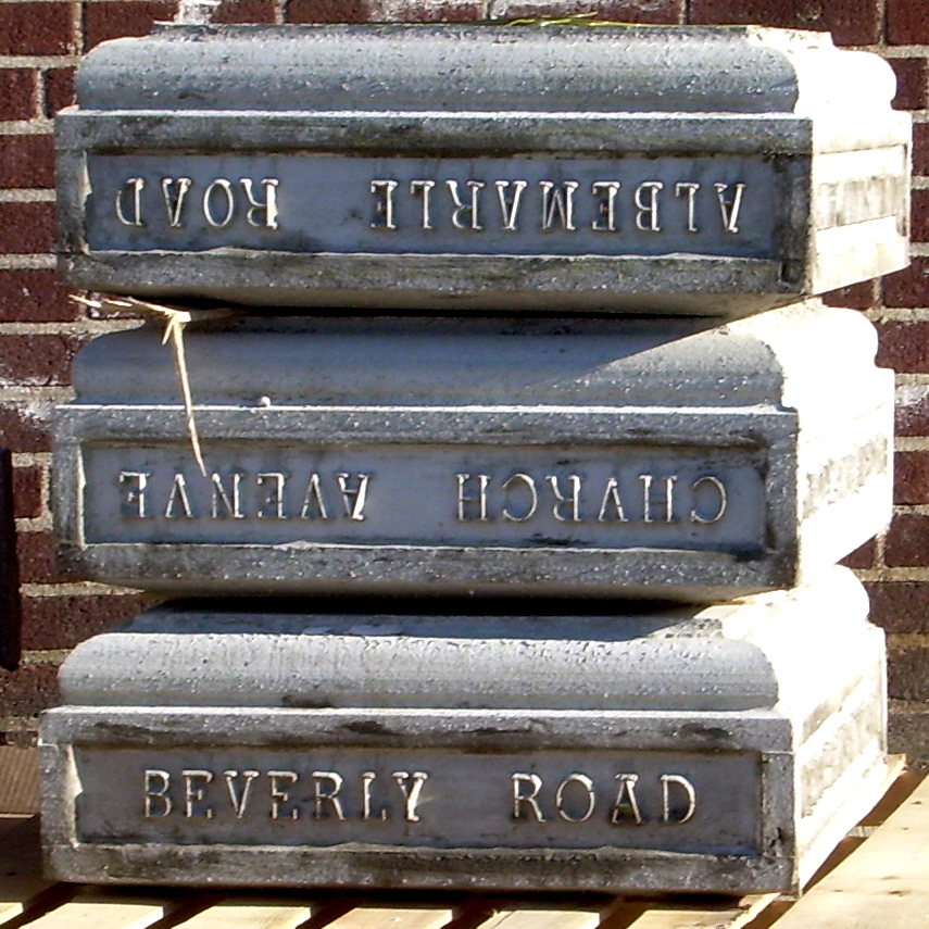
Bonus photo from the archives:
63rd Street, Borough Park
posted by Gary @ 1:18 PM
2 comments
![]()

2 Comments:
Very smart planning. I, on the other hand, am left mostly with the outer edges in the hills of Berkeley. Of course it doesn't matter as much weather and transportation wise here...
Well, time will tell how smart it really is. But I'm hoping a little work now with the map will save a lot of headaches down the road. We'll see!
Post a Comment
<< Home