12 August 2006

Saturday New Shoes and Charity Running Edition

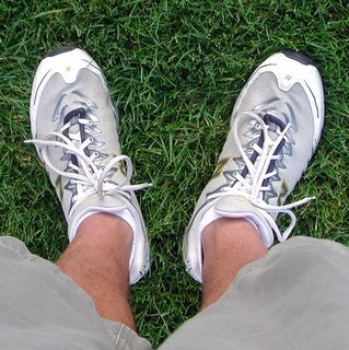
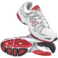
I got new shoes yesterday. For a runner this is often a really big deal, since many of us have developed oddly emotional and intense relationships with a particular make and model of shoes. Or maybe it's just me. Anyway, I've been wearing the New Balance 827 series for years (I think I began with the 829 and worked my way up through the 833 over the years). They're comfortable, very light, and reasonably priced, as far as these things go. Interestingly, the company has apparently decided to "reset" the model numbers back to 825, so that's what I got. Yeah, I know, they're not much to look at, but then again, when's the last time you saw a good-looking pair of running shoes?

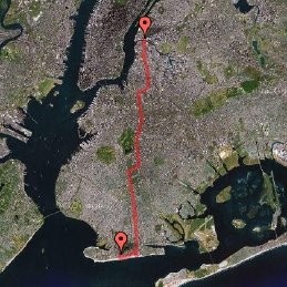
In other news, I got an email this week from one Jeff Eckhaus. As most runners (and New Yorkers) know, the 2006 New York Marathon is coming up on November 5. I won't be running it, since I didn't know I was moving to Brooklyn until after registration was closed (hopefully, I'll get in next year). But Jeff is running, and moreover, has decided to use the race to try to raise $2500 for Team for Kids, the New York Road Runners charity which works to keep kids fit and fights childhood obesity. If you'd like to help Jeff reach his goal (or learn more), drop him an email at eckhaus@gmail.com.

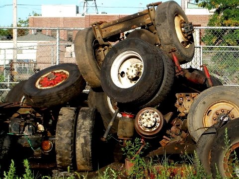
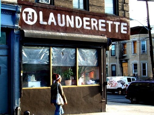
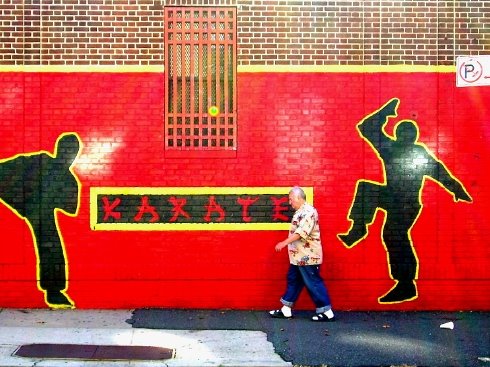
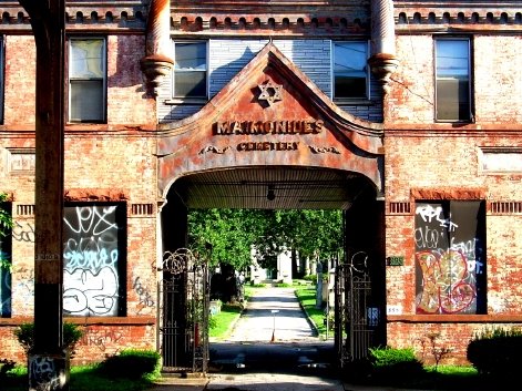
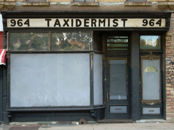
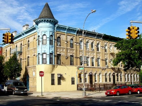
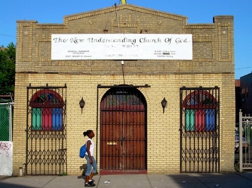
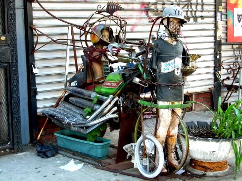
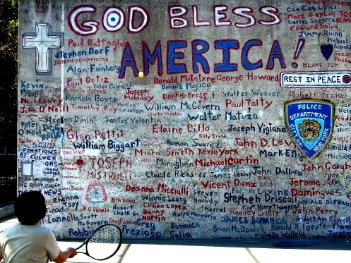
Hope everyone's enjoying the terrific weather. Here are a couple of bonus pictures from the past week:


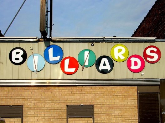
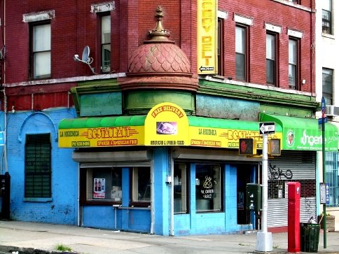
3 Train, Brownsville


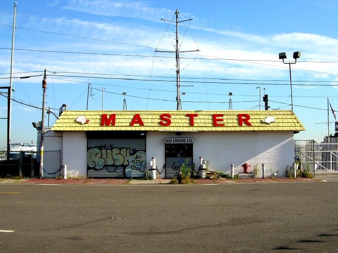
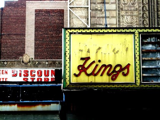
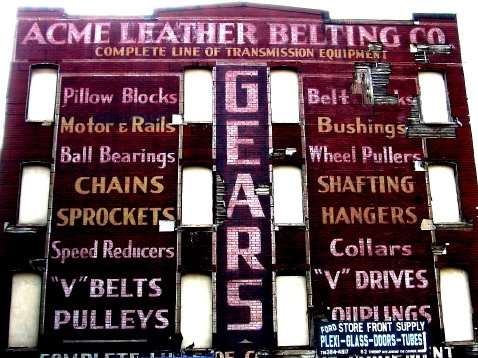
Jamaica Avenue, Cypress Hills

11 August 2006

Pressing Eastward (or, Finding the Hills in Cypress Hills)

Friday 8/11: East New York, Cypress Hills, Bushwick

Distance: 9.72 miles
Time: 1:15
Pace: 7:43
Temp: 70
Dewpoint: 56
Weather: sunny & breezy


click on image for interactive map

Unique Miles Today: 8.40
Total Unique Miles:
235.68
Percent of Brooklyn Run:
13.53

Route: I started at the corner of Van Sinderen and Atlantic, ran south a block to Liberty Ave, took Liberty east to Drew, went up to 95th, over one block to Forbell, back down to Liberty, and west another block to Eldert Lane. Then I toon Eldert up to Jamaica and then headed west to Bushwick Ave (with an out-and-back detour through the cemetery on Cypress Hills Road), up to Weirfield, then over to Wycoff and down two blocks to Eldert Street. I took the L home.

Notes: Continuing my recent tendency to alternate between tonier neighborhoods and more marginal ones, I headed out to the farthest eastern reaches of the borough. Getting off the L train in the relative desolation of the border between Brownsville and East New York, I found myself questioning my decision, but as I ran east on Liberty Avenue the neighborhood began to grow on me. Yes, the area's clearly got its problems, but there was also a lot to see, and as I looped around into Cypress Hills I noticed quite a number of handsome, well-kept rowhouses and tree-lined streets. Running back west on Jamaica Avenue was particularly interesting, with a succession of cemeteries on my right, the elevated tracks running over the street, and small businesses and houses on my left. Because it's within the boundaries of the borough, I ran up Cypress Hills Street through the cemetery and up to the entrance to the highway, and I'm assuming this is where the neighborhood gets its name -- I think it's the steepest portion of road I've run thus far. Here's the elevation chart for today's run: The numbers didn't come out well, but the elevation of Cypress Hills Street increases from about 60 to 170 feet over a distance of about 2280 feet, for about a 5% grade. I think. It's not so hard to see where the hill is on the graph.


As with other less affluent areas I've run, there was a lot to take in visually. The most unusual thing I saw today was probably the taxidermy shop on Jamaica Avenue (I included the picture below). Is there a real demand for this kind of thing in eastern Brooklyn? I'm also growing pretty fond of Bushwick, which while still a little rough around the edges seems to have any number of quiet streets full of great old houses and lined with sycamores.

Whatever. I'll take tomorrow off, as usual, and come back with a longer run on Sunday. Have a great weekend, kind reader, but first take a moment to peruse today's pictures:


Truck axle graveyard, Liberty Avenue


Corner of Liberty Avenue and Eldert Lane


Why it's important to watch your back (off Jamaica Ave)


Entrance to Maimonides Cemetery


Is it me or does this seem like an unlikely business for Cypress Hills? (Jamaica Avenue)


Corner of Bushwick Avenue and Granite Street

10 August 2006

Suburban Stairs and Other Delights

Thursday 8/10: Bay Ridge

Distance: 8.60 miles
Time: 1:10
Pace: 8:08
Temp: 73
Dewpoint: 63
Weather: partly cloudy


click on image for interactive map


Unique Miles Today: 7.78
Total Unique Miles:
227.28
Percent of Brooklyn Run:
13.04

Route: I started at 95th and 4th Avenue, ran down to Shore Road and then followed Shore up to Narrows Avenue, passing through the grounds of Fort Hamilton High School (including the semi-circular drive out front) and up to Owls Head Park. I then headed west, around the park on Shore Road and then headed back south on Colonial Road. I took Colonial to Marine, over to Ridge Boulevard, north to 67th Street, west back to Colonial, up a block to Wakeman, down Sedgwick and back up Bergen and back to 67th, at which point I ran east to 4th Avenue, down to Bay Ridge Parkway, over to 3rd Avenue, then north back to 67th.

Notes: After the visual feast in Brownsville and Bushwick yesterday, I decided to go to the opposite end of the borough for today's run. The parts of Bay Ridge I covered were nice enough -- a lot of beautiful old apartment buildings near Shore Road, and a lot of attractive though very suburban-looking homes on the other streets -- but, as with my run in Sheepshead Bay a couple of days ago, there just wasn't a whole lot of things that jumped out at me and demanded photographic representation.

One pleasant (though not particularly photogenic) surprise was the staircases connecting the dead-end portions of 74th and 76th Streets between Colonial Road and Ridge Boulevard. The two portions of these streets are at different elevations, but although car traffic can't continue, broad, landscaped staircases connect the two sides for pedestrians. They weren't on my map (which shows both streets as continuous), but naturally, I had to go up and down both sets. I don't know how much use they get, but as a compulsive pedestrian, I applaud their mere existence!

Today's photographic installment:


Fort Hamilton Park


Bay Ridge Branch of the Brooklyn Public Library


Off of Colonial Road


Corner of Bay Ridge and 3rd Avenues

09 August 2006

Subways and Snowboards

Wednesday, August 9: Bushwick, Brownsville, Bedford-Stuyvesant, Williamsburg, Greenpoint

Distance: 9.53 miles
Time: 1:15
Pace: 7:52
Temp: 70
Dewpoint: 60
Weather: sunny & breezy


click on image for interactive map

Unique Miles Today: 9.15
Total Unique Miles:
219.51
Percent of Brooklyn Run:
12.60

Route: I began at the Dekalb Avenue stop on the L, then ran east to St. Nicholas, south to Bleecker, over a block to Cypress, down a block to Menahan, back to St. Nicholas and on to Gates, right on Gates to Wyckoff, and then on to Halsey. I made a right on Halsey, which I followed to Saratoga, and then went south on Saratoga to Dumont, turned right on 98th, another right on Ralph, and followed it back up to Halsey. Then left on Halsey, north on Patchen, left on Broadway, right on Sumner, left on Humboldt, west on Powers, and then north on Manhattan to Norman.

Notes: Today dawned cooler and drier, and I was up early to greet it. After spending yesterday systematically running up and down quiet little streets in Sheepshead Bay, I figured a change of pace was in order and planned a looping route through Bushwick, Brownsville, and Bed-Stuy. And what a difference -- yesterday, I despaired at finding interesting subjects to photograph; today, I could've easily taken 50 (I deliberately keep only a 16 MB card in the camera, which limits me to about 25 two-megapixel shots and reduces the tempatation to spend too much time snapping pictures).

Speaking of pictures, I'm keenly aware of the potential for appearing as nothing more than some kind of opportunistic tourist, slumming his way through the shabbier neighborhoods in search of "authentic" urban tableaux. But in my experience so far, there really do seem to be more interesting opportunities for photography in some of the lower-income areas.

Moreover, my runs in places like East New York and Brownsville and parts of Crown Heights and Bed-Stuy seem to really fascinate people -- the most common question I get about this whole thing (whether in person or via email) is "aren't you worried about the 'bad' neighborhoods?" My answer's always the same: I'm as concerned about my safety as anyone else is in the big city, but I also engage in the usual precautions -- other than the camera I don't carry any valuables, I try to keep aware of my surroundings at all times, and I don't run at night.

I do, however, come into contact with people from time to time, for better or worse. Just today, for instance, I was stopped twice in Brownsville. The first time was by a young guy who was part of a crew painting the elevated subway tracks, and who was somewhat suspicious (at first, at least) about my taking pictures. We chatted for a minute and he softened up once he realized I wasn't there to check up on him and his co-workers. The second time was by a frantic guy trying to unload one of the more improbable pieces of stolen merchandise to be found in Brownsville in August -- a snowboard. I told him to try me again in December.

In any event, I made it home safely. And the weather was fantastic, especially compared to the recent above-average warmth and humidity. All in all, a great run. Here are some pictures:


Barbershop on Halsey Street


Garden on Saratoga Avenue


Church on Ralph Avenue


Broadway, Bushwick/Bed-Stuy line


Motorcycle... sculpture? (also on Broadway in Bushwick)

08 August 2006

Back to the Bay

Tuesday 8/8: Sheepshead Bay

Distance: 9.30 miles
Time: 1:15
Pace: 8:04
Temp: 74
Dewpoint: 66
Weather: sunny & breezy

click on image for interactive map


Unique Miles Today: 7.61
Total Unique Miles:
210.35
Percent of Brooklyn Run:
12.07

Route: I started at Sheepshead Bay Road and 16th Street, headed north on 16th to Avenue Y, east to 29th Street, south to Voorhies... and then a whole lot of back-and-forth to cover all the little streets and alleys between Voorhies and Emmons, from Nostrand to Knapp, as well as Harkness and the extension of Emmons to the east of Knapp. After finishing this up, I went north on Nostrand to Avenue X, west to 23rd, south to Jerome, and took Jerome back to the subway station.

Notes: Now that I'm based up in Greenpoint, I've been thinking I should probably cover the far southern reaches of the borough now, so I won't have to make as many long subway journeys in the winter. So today I revisited Sheepshead Bay, systematically covering a number of small streets and residential alleys within a block north and south of the Belt Parkway. The weather this morning -- a dry, northwest breeze and bright sunshine -- was great, though the run itself didn't offer much to write home about. It was mostly a residential area, with some very pleasant, tree-lined streets (though close to the highway, of course), and a good number of new hotels and apartment buildings going up along or near Emmons. Like the last time I visited the area, my favorite part was probably running down the narrow little pedestrian alleys lined with cottages, though the water views of the bay and Shell Bank Creek weren't too bad, either. A fine run, to be sure, and a pleasant neighborhood, but keeping track of my route (lots of backtracking, overlapping, and dead-end streets) was kind of a drag, and photo-wise, there wasn't a whole lot to catch the eye. In any case, here's what I've come up with today:


Park off of Avenue X


At a restaurant off Harkness by Shell Bank Creek


Windowbox on Batchelder


At the very end of Emmons Avenue

07 August 2006

The Road Less (Randomly) Traveled

Today, like most Mondays, is an off day for me. But given how much I enjoyed yesterday's long run from the Coney Island boardwalk to the Pulaski Bridge in Greenpoint, I've been thinking about other long runs with that would have a specific purpose (other than simply filling in streets on the map). Brooklyn offers any number of possibilities like this, and I've compiled the following short list of potential runs that fit the bill. I'd also like to solicit suggestions for others from you, the blog-reading public. If you have ideas, just drop me an email or leave a comment. I'm open to almost anything, as long as it's physically realistic (i.e. under 15 or so miles in length) and wouldn't require me to bring along a big map or anything while I run. Here's what I've come up with thus far:

1) Atlantic Avenue, from the border with Queens in East New York to its terminus at Brooklyn Bridge Park. As far as I can tell so far, Atlantic is the only street stretching continuously from one end of the borough to another. Approximate distance: 7+ miles.

2) The Queens/Brooklyn border. Last week I ran some of this boundary (between Bushwick and Ridgewood), but there's the stretch from Cypress Hills down through East New York, from Cypress Hills Cemetery to Old Mill Creek down near the Gateway Center Mall. Approximate distance: 7.5 miles

3) Following the elevated portions of various subway lines.

4) Traversing all three East River bridges between Manhattan and Brooklyn. Approximate distance: at least 8 miles, depending on the route.

5) The length of Kings Highway, from its intersection with Eastern Parkway in Brownsville to where it meets up with Bay Parkway in Bensonhurst. Approximate distance: 6.7 miles

These are just the results of a few minutes of map-gazing. If anyone has other suggestions, let me know! Meanwhile, here are a couple more pictures from yesterday's run (the picture up top is from Lorimer Street in Williamsburg):


Coney Island Avenue, Sheepshead Bay


Memorial for cyclist Liz Byrne, who was killed last fall (corner of Kent and McGuinness in Greenpoint)

06 August 2006

Brooklyn, From the Bottom Up

Sunday 8/06: Coney Island, Brighton Beach, Sheepshead Bay, Flatbush, Prospect-Lefferts Gardens, Crown Heights, Bedford-Stuyvesant, Williamsburg, Greenpoint

Distance: 13.88 miles
Time: 1:55
Pace: 8:17

Temp:
75
Dewpoint: 62
Weather: mostly sunny

Unique Miles Today: 13.75
Total Unique Miles:
202.74
Percent of Brooklyn Run:
11.64

click on image for interactive map

Route:
I started at the 8th Street subway stop, then ran south to the boardwalk, east to Beach Walk, up to Brighton Beach Avenue, east to Brighton Beach 7th, south to Brightwater Court, east a block to Coney Island Avenue, back down to the boardwalk and then west two blocks to Brighton Beach 6th, up to Ocean View Lane, and then over to Coney Island Ave. The rest is pretty straightforward: I headed north up Coney Island to Cortelyou, east to Flatbush, then up to Washington for a few blocks before heading up Franklin. I took Franklin to Wallabout, then headed east to Lorimer, north to Cayler, east to McGuinness, and north up onto the Pulaski Bridge. When I got to the sign that said "Welcome to Queens," I stopped and walked back home.

Notes:
A week ago I mused about the different types of runs I might try to keep things interesting, and one that I contemplated was the "themed run," which is pretty much what it sounds like. The thing is, it was only a theoretical construction, something I'd thought about but had not, thus far, put into practice. So today I decided I'd try my first high-concept excursion, and after rejecting a few ideas I settled on running from the southern edge of Brooklyn (along the ocean in Coney Island) straight north up to Newtown Creek, the border between Greenpoint and Queens -- the entire borough, from bottom to top.

So at about 6:30 this morning I took the G to the F to Coney Island (which took over an hour in of itself), ran my first ever stretch along the boardwalk, and then headed north. My route was chosen largely for its straightness (the whole shortest distance between two points thing), and since I followed major thoroughfares like Coney Island and Flatbush Avenues it was mostly commercial without a lot of residential areas other than large apartment buildings. The weather was great (well, at least for August), and there were some serious Brooklyn landmarks along the way, including the Flatbush Reformed Dutch Church, Erasmus Hall High School, and the (now decaying but apparently once quite grand) Loew's Kings Theater. I passed dozens of tire places, bodegas, restaurants, and other ubiquitous fixtures of the Kings County urban landscape, as well as the requisite old factories, warehouses, empty lots, hundreds of people, and the much-documented ODB mural in Bed-Stuy. As usual, then, there was plenty to see.

All in all, it was a great run. Moreover, it was fun (well, as much fun as running a distance longer than a half-marathon can be on a summer morning), and it's pretty cool to have gone from one end of the borough to the other on foot (it's also kind of impressive to see it all laid out on the map). I'm definitely going to schedule more of these runs in the future, though I'll probably keep them earmarked for Sundays, which is when I usually go long.

Speaking of long... because this was the longest run I've done so far (and the first one with a specific geographic purpose), I've included a few extra pictures today, including one from the very beginning of the run and one from its conclusion. Enjoy.


Outside the New York Aquarium in Coney Island


Bank on Coney Island Avenue


Loew's Kings Theater on Flatbush Avenue


18th Century gravestone outside the Flatbush Reformed Dutch Church on Flatbush Avenue


Restaurant on Franklin Ave


Does that say "dogs" or "docs?" Good advice either way (Franklin Avenue)


Lorimer Street, Williamsburg


Newtown Creek -- the Gowanus Canal of the North